
STRATFORD HOUSE,
5 CORTLAND AVENUE, ECCLESTON, CHORLEY, PR7 5FP
Tel: 07940 372868
Info@charteredtownplanner.co.uk
ESTABLISHED 1993


Architectural Drawings | Conservation Area and Listed Building Consent Advice | Design and Access Statements
Land Development Appraisals | Planning Appeals | Planning Applications | Formal Planning Objections
ASHALL TOWN PLANNING
CHARTERED TOWN PLANNING CONSULTANT
Andrew Louis Surveyors
Beechwood Motor Group
Bigger Picture Projects Ltd
Blue Line Properties Ltd
Blue Sky Projects Ltd
B W Autocentres
Cosaf Environments Ltd
Cross House Hotel Ltd
Derwent Living
Factory Plant Projects Ltd
Fraser Homes
George Wimpey (NW) Ltd
H & D Homes Ltd
Holmfield Builders Ltd
Huf -
J.B. Armstrong & Co.Ltd
K.B.A. & E.M. Dev Ltd
KnowledgePoint360
Knowsley Borough Council
Leapfrog Day Nurseries Ltd
Leverton Environmental Ltd
Liverpool Motor Auctions Ltd
Lloyds TSB Group plc
Long Eaton Group Ltd
Lupset Hotel Ltd
Mapp Developments Ltd
Margram Plc
Maurice Hill Transport Limited
Metropolitan Development Group
Miller Brothers
Mobile Motor Mechanics
My Nursery Ltd
Nightingale Nurseries Ltd
Nottingham Building Society
Nottingham Property Services Ltd
Novalia
Pho Restaurants
Provincial Racing Services Ltd
Puzzle Pub Company Ltd
Restriver Limited
Retail Space Management
Royal Britannia Hotel
Scuffs Auto Centres
Sleekmade Property Co Ltd
Specialist Recruitment Services Ltd
Sportsmania Ltd
Structured Designs Limited
Swan Homes
The Healthworks Company
The Kid Company
Tiny Tots Clothing Ltd
Together Group
Tom Cobleigh plc
Total Oil plc
Trent Lock Golf Centre
Ultimate Kitchens Ltd
Wazobia Restaurants
Royal Town Planning Institute Membership No: 31305 -

30
30
1993
1993
2023
2023
LATEST NEWS .....
Our planning appeal success continues .....
Appeal allowed and a full award of costs against a London Council
Be part of our success -
and let us handle your planning application or planning appeal.
Raymond Ashall BA Hons Dip EP MRTPI
Chartered Town Planner
Member of the Royal Town Planning Institute
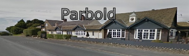
Planning Consultants for the Parbold and West Lancashire Council area
We provide a comprehensive range of planning services for the Parbold and West Lancashire Council area.
Ashall Town Planning are based in Chorley, Lancashire and are ideally positioned to provide a bespoke and professional planning service in the West Lancashire Council area to assist householders and developers to successfully obtain Planning Permission.
If you are seeking professional independent Planning or Property Development Advice, require Planning Drawings or advice on a Planning Permission Application to West Lancashire Council, as Chartered Town Planning Consultants we are the ideal people to guide you through the planning process and to help you obtain the planning permission you need.
Having been established for over 30 years we have a vast experience of dealing with Planning Officers from West Lancashire Council, acting as your agent with West Lancashire Council you will benefit from our many years of experience giving your application the greatest chance of success.
We offer the following services:
Architectural Planning Drawings
Architectural Plans
Architectural Drawings
Access to Chartered Architect services
Planning Appeals
Permitted Development Applications (Lawful Certificate)
Planning Permission Applications for House Extensions & Loft Conversions
Retrospective Planning Applications
Planning Permission Applications for Change of Use Class
Planning for Commercial Properties
Planning Permission Applications for Converting a House to Flats
House in Multiple Occupation Applications
Planning Permission Applications for New Build Developments
Planning for Childrens Day Nurseries
Planning for Pubs & Restaurants
Planning for Motor Trade & Car Washes
Planning for Takeaways & Restaurants
Listed Building Consent Applications
Conservation Area Applications
Ashall Town Planning Consultants cover all areas in West Lancashire, including Ashurst, Aughton, Bickerstaffe, Birch Green, Burscough, Digmoor, Downholland, Halsall, Knowsley, Newburgh, North Meols, Ormskirk, Parbold, Rufford, Scarisbrick, Skelmersdale, Tanhouse, Tarlton, and Up Holland.
Parbold- West Lancashire - Planning Department Contact details:

Over 30 Years of
Planning Success
Chartered Town Planning Consultants Ashall Town Planning can provide you with the best possible advice when submitting a planning application in Parbold.
Please read our Client Testimonials
Planning Permission
Granted
Planning Applications
Approved
Planning Appeals Won
See our
Approvals page
Parbold -
Parbold -
Parbold -
Parbold -
Parbold -
Parbold -
Parbold Conservation Area
The Mill Lane Conservation Area was designated by West Lancashire District Council in 1975 and was last reviewed, in part, in 1985. The conservation area covers a portion of the village of Parbold to the south of the railway line, totalling just over 6 hectares, and is defined by development on either side of Mill Lane, which forms the main village street, and Bradshaw Lane to the south of the A5209.
The area forms one of the historic cores of Parbold, comprising houses and small-
Location and Landscape Setting
Parbold is situated on the lowest slopes of Parbold Hill, on the edge of the West Lancashire plain at NGR SD 491 109 (centred), just off the A5209 road to Ormskirk from Standish. It is situated around 8km from Ormskirk to the west and around 4.5km from Skelmersdale to the south.
Lying at the base of the hill, the landscape in and to the west of Parbold is gently
rolling, and slopes down to the River Douglas to the west and south. To the east
of the village, however, land rises sharply to Parbold Hill at around 130m a OD.
The countryside is a lowland area of mixed arable and pasture farming comprising
mainly improved pasture with arable fields. The field pattern is large-
View the Parbold Conservation Area Appraisal document